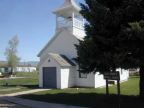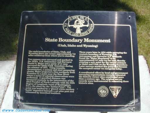
State Boundary Monument
(Utah, Idaho and Wyoming)The state boundaries of Idaho, Utah, and
Wyoming share one corner approximately 7.3
miles southwest from where you're standing.
Two corners were surveyed and marked in
the 1870's. U.S. Astronomer and Surveyor
Daniel G. Major and a party of 11 men
surveyed the Idaho-Utah boundary during
the summer of 1871. Using transits,
Chronometers, a sextant and steel measuring
chains, Major projected a line northerly from
Evanston to a point near the Bear River
where a series of celestial observations were
performed. A specified distance was
measure westerly to the intersection of the
42nd Parallel of North Latitude with the 34th
Degree of Longitude (west of Washington,
D.C.), the place for the "Initial Point". The
point was marked by a "glazed white earthen
bottle" deposited beneath a set pine post and
witnessed by inscribed boulders.
Three years later in 1874 while surveying the
western boundary of Wyoming, U.S.
Astronomer and Surveyor A.V. Richards
found the "Major Monument" to be
approximately 0.7 mile too far east, thereby
creating a new point for the corner common
to Idaho and Utah on the Wyoming boundary.
Later surveys marked this point that became
the accepted corner we recognize today.
A coordinated effort by local and government
surveying organizations recently relocated
the historic corner sites established more
than a century ago. The original survey
records were instrumental in relocating these
historic sites.