Entry Points:

About Tunp Mountains
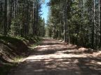
The Tunp Mountains run north to south near the western borders of Wyoming. They lie mostly just under 9,000 feet in elevation, with a couple peaks above that. They receive abundant winter snows, and are covered in alpine forests and meadows with numerous creeks. They are bounded (roughly) by the Hams Fork Valley to the east, Smiths Fork Valley on the west, and Hobble Creek and Contag Creek to the north. Southward the elevation declines and they end in a wilderness of hills that extend to the southeast and southwest. These ultimately end at the Bear River Valley to the southeast, and the valley of Twin Creek to the south. U.S. Highway 30 heads west along Twin Creek, and turns north at the Bear River Valley, thus avoiding the altitudes of the Tunp Mountains.
More mountains lie to the north that are not considered part of the Tunp Range, but are effectively contiguous. This includes the Commissary Ridge to the northeast. The Tunp Mountains are in the Bridger National Forest.
Street Index
|
a dirt road a road a turnout Big Spring Road |
F.S. Route 10062 F.S. Route 10069 F.S. Route 10193 F.S. Route 10198 |
Hams Fork River Hams Fork Road Pine Creek Road |