Entry Points:

About Sublette County
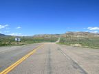
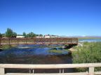
Sublette County covers 4,883 square miles in western Wyoming. The Wind River Mountains form its northeast boundary, and the Wyoming Range lies on its western boundary. The hilly highland plains of Wyoming cover its central and southern areas. The Green River flows southward from its sources in the Wind River Mountains. The mountains are forested and majestic, and the plains are windy and lonely with a few scattered towns.
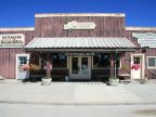
Pinedale is the county seat and largest town. Rich oil and gas fields lie within the county and supply the major industry. Cattle graze on the miles of plains. U.S. Highway 189 passes north and south through the county, roughly following the Green River. U.S. Highway 191 enters the county from the southeast and meets highway 189 near Pinedale. They share a combined route from there northward.
The population of Sublette County was 5,920, as of 2000, giving it a population density of a little more than one person per square mile. The elevations range from about 6,570 feet on the Green River to 13,804 feet at Gannett Peak (which is the highest point in Wyoming).
For More Information:
See the Wikipedia Sublette County article, the county's official site or the Chamber of Commerce site.